Frequently Asked Questions

Who is paid for the study? 

Chelan-Douglas Transportation Council is funding this project with a federal planning grant and additional contributions from partner agencies including Chelan County, Link Transit and the cities of Cashmere, Entiat, Leavenworth, and Rock Island. 

Who will pay to build these pathways?

The plan identifies a diverse mix of funding sources to ensure financial sustainability for both construction and long-term operations:

  • State and Federal Grants
    •  Programs such as Transportation Alternatives (TA), Surface Transportation Block Grant (STBG), Active Transportation Infrastructure Investment Program (ATIIP), and Safe Routes to School.
    • Competitive grants for resilience (PROTECT), carbon reduction, and recreational trails.
  • Local Partnerships
    • Collaboration with cities, counties, and Link Transit for integrated mobility solutions.
    • Potential cost-sharing agreements with utility districts and parks departments.
  • Nonprofit and Philanthropic Support
    • Engagement with organizations like Chelan-Douglas Land Trust, Complete the Loop Coalition, and regional foundations.
    • Opportunities for in-kind contributions and volunteer support for maintenance.
  • Nontraditional Financing
    • Value capture mechanisms such as Special Assessment Districts (SADs), Tax Increment Financing (TIF), and Transportation Utility Fees (TUF).
    • Public-Private Partnerships (P3s) for design-build-maintain contracts.
    • Green financing options (e.g., green bonds) for environmentally focused segments.

When will the pathways be built? 

Now that the Pathways Master Plan is complete and the community has a clear vision for buildout of a pathway network, it will be possible to apply for state and federal grant funding to refine final designs and construct new pathways. The master plan includes a tiered phasing strategy for each pathway corridor designed to balance feasibility, cost, and community priorities.

Who will maintain the pathways? 

The agencies responsible for management, maintenance, and operations of each pathway corridor will be determined as a part of the project study.  

Why can’t people just walk or ride on existing roads? 

Based on community input, CDTC is looking to create a safer and more direct transportation option for people of all ages, abilities, and comfort levels to walk or bike between communities in the region.

Will the pathway be paved or dirt? 

The pathway will be paved.  

Will eminent domain be used?  

No. Eminent domain will not be used to purchase private land from unwilling sellers.

Will E-bikes be allowed?  

Yes. E-bikes make it possible for more people to pedal bicycles, particularly uphill. E-bikes are already creating more use of the Apple Capital Loop Trail and demand for better cycling routes.

Will the pathways impact emergency response and access?

The pathways are planned and designed to preserve and where possible enhance emergency access. This includes maintaining clear corridors for fire, medical, and law‑enforcement vehicles and ensuring that any new infrastructure, such as bridges, boardwalks, undercrossings, or roadway crossings, meets applicable emergency clearance and load requirements.

During the planning process, the project team worked directly with WSDOT and local emergency responders to understand access needs, staging requirements, and emergency response protocols within each corridor. This coordination guided the project team so that the recommended designs do not compromise emergency operations and in some cases may improve traffic flow and emergency response.

As the pathways move from planning into final design and construction, ongoing collaboration with local fire districts, EMS, law enforcement, WSDOT, and public works agencies will be essential. Each segment will undergo updated engineering review to ensure that roadway modifications, pathway widths, and crossing treatments maintain emergency access. This includes continued evaluation of lane narrowing, traffic calming, and right‑of‑way constraints to confirm they do not hinder emergency response.

In constrained areas, maintaining emergency access may require adjusting pathway width to 10 feet, shifting the roadway, or incorporating barriers, depending on the corridor context and safety standards in effect at the time of design. These decisions will be made case‑by‑case with direct input from the agencies responsible for emergency response.

Why is there no trail connection to Entiat?

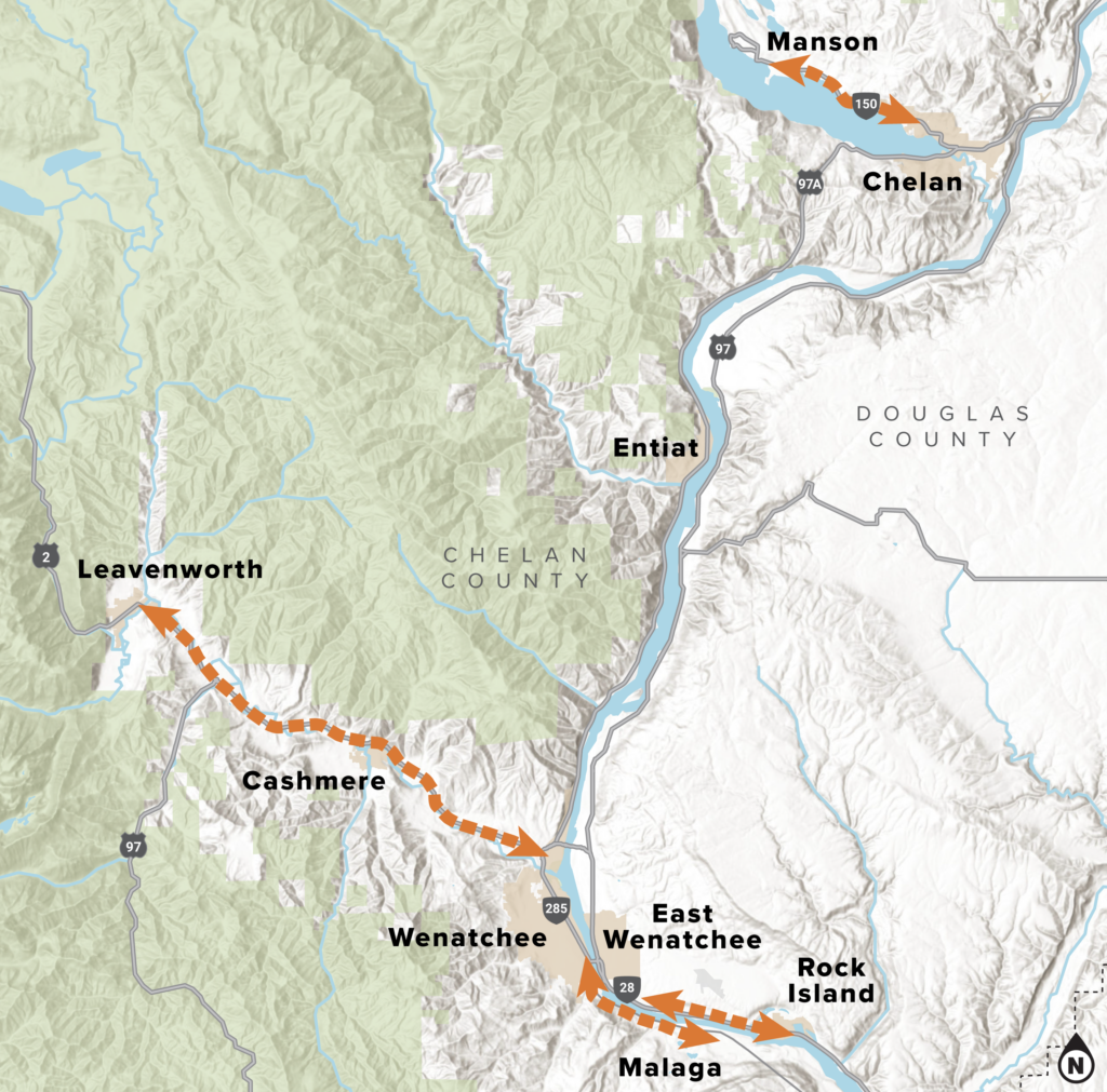
The SR 97A highway corridor through Entiat is tightly constrained by steep slopes, the Columbia River, and an active railroad. The possibility of connecting Entiat north to Chelan and south to Wenatchee will be studied, and may become a fifth pathway corridor if a feasible route is identified.

When can I see the recommended routes?

Executive summaries of each pathway’s recommended routes are available here. You can also find more detailed information about each plan and the entire project in the Chelan-Douglas Pathways Master Plan.


Click image to zoom